The Malvern Hills may dominate the scenery, but there is a mixture of cycling country around Malvern. This page should help you get out there and enjoy being on your bike.
- Riding the Malvern Hills, places to park the bike.
- Planning a ride Suggested local cycle routes, wider cycling guides, other bike maps.
- Getting to the start using public transport.
- Venturing further Information for those travelling beyond the immediate area.
Also See
- Refreshment stops near the Hills.
- Local towns and villages worth a visit on a day’s bike ride, with some food and drink suggestions: North and East from the hills, South and East, or West.
- Cycle Malvern group has info on cycle racks in town (and photos).
- Cycle Shops, bike hire, local groups and holidays for cyclists.
- Local cycling groups, plus sportives and other events.
- Getting to/around Malvern by train/bus.
- The Elgar Connection A famous local cyclist.
- Cycling holidays – heart of England, Welsh borders.
- Cycle Time photo album.
- Writing about cycling page includes a Miscellany – cycling past, jewellery, daft stuff.
On the Road and Trail
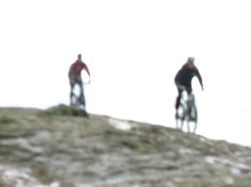
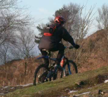
Enjoy riding on the Malvern Hills
The main Hills paths vary from the odd tarmac ones via reasonably well drained and level to rough, rocky and quite steep. You’ll need to be confident in your brakes and experience for the latter. There can be a lot of walkers particularly in good weather (not just the summer nowadays), from families with toddlers and tearaways, elderly and less nimble slowcoaches to serious ramblers. Please be considerate and give space for others. The southern end of the hills is generally quieter, but also has less permitted tracks.
The Malvern Hills Trust (Conservators as was, responsible for most of the land) has produced a map and guide for walkers and cyclists (April 2018). MHT news item or go direct to their cycling page with links to the downloadable material, which should also be available in printed form from “MHT offices, local Tourist Information Centres, cafes, bike shops, and other visitor attractions”.
There are a couple of tempting flatter paths which are clearly marked as not for use by cyclists (and horse riders) – they are intended for use by the less fit/active instead. See below for how to identify where you can cycle – basically the main paths as far south as British Camp car park, and just a couple of options on from there.
You might also want to get hold of a full area map, such as OS Explorer 190 (scale 1:25,000), which covers Bredon too, or Harvey’s Malvern Hills Superwalker (1:10,000). See Outdoor Links for more map info.
Extract from MHT’s guide to cycling on the Malvern Hills:
• Cyclists are welcome on the bridleways of the Malvern
Hills and Commons and the permissive cycle paths
where cycling access has been granted by the Malvern
Hills Trust (as shown in the guide).
• To help you find your way we’ve created waymarked
cycling trails around the Hills *. For route maps and
information please visit www.malvernhills.org.uk/
visiting/cycling.
• The Herefordshire Beacon (also known as British
Camp), the Shire Ditch and Midsummer Hill are
protected archaeological monuments so please avoid
these on your ride.
• Please give way to walkers and horse riders and be
courteous and patient with other path users who may
be going more slowly than you.
• Please cycle at a sensible speed as there could be
children, dogs and livestock anywhere on the Hills at
any time.
• Please carry a bell and use it or call out clearly to
avoid surprising people as you approach. Carefully
pass other visitors.
• The Malvern Hills can be very busy at weekends and
on bank holidays. You may enjoy your ride more by
cycling outside the busiest periods.
With your help, wildlife can continue to thrive and
visitors and local people will be able to enjoy this iconic
landscape for years to come.
(end of extract)
* The three waymarked trails, Short, Medium and Long, with route cards and GPX files, are all in place from April 2019.
Cycle info
Cycle parking on the Hills
Includes Sheffield style tubular racks at the following car parks:
- Upper Wyche (right at the top), several racks
- Wynds Point (British Camp, on the left looking from the road), pair of racks.
- Racks at North Malvern and Tank Quarries may have gone.
Pair of racks also available at Swinyard car park, top of Castlemorton Common – at our request. This is a great place to start a walk such as our Three Counties Loop.
Both Cafe H20 (top of Walwyn Road near Wyche Cutting) and Sugarloaf Cafe (West Malvern Road above Croft Bank) have cycle racks. Check out inside Sugarloaf Cafe for some extra cycling interest!
Download GPX file of bike rack locations.
Local Cycling Routes
Printed maps and guides listed below should be available from relevant Tourist Information Centres (TICs) in Herefordshire or Worcestershire. Link to Malvern TIC. Many can also be ordered via Come Cycling Ledbury website.
There isn’t yet much in the way of National Cycle Routes (Sustrans) in the area – see Cycle Malvern routes info for what may be planned for the future. Also see Getting to Malvern for Worcester connections.
To give you an idea of the network of roads (and some paths) we enjoy cycling in the area, a whole bunch of GPS logs have been compiled into an outline ride guide graphic. We might provide some annotation in a while, but meanwhile you can enjoy identifying key spots (a clue or two: north west corner is Bromyard, south west is Ross).
Around Malvern
- Elgar Ride Variations reprinted Sept ’02. Six cycle routes around the Malverns, all but one starting in the town. May now be out of print.
- Malverns Off-road Cycling Maps published July ’02, £3-50 each. Circular routes on bridleways and quiet lanes – Map 1 has six to the east of the Hills, Map 2 eight to west and north. (None are on the Hills themselves). Produced in partnership with the AONB by Colin Palmer aka Offroad Cycling. Copies may still be available from local tourist info centres.
- By Bike in the Foothills of the Malverns A Malvern Hills AONB leaflet available from their website – note this is a large 27.4MB pdf download. Maps and places of interest for three cycle rides round the area of 15 to 26 miles: Colwall and Cradley, Storridge and Knightwick, British Camp and Bromesberrow. (The suggested fourth ride of joining the 3 together is probably not of interest to most people, but we’ve created our own variation in TrackLogs format, coming to about 52 miles with further suggestions for short cuts.) There aren’t any cycling instructions, so do take care turning on or off the few main roads, especially between Eastnor and Ledbury on the British Camp ride.
- A literary trail around the Malverns, from Malvern Hills AONB, designed for car and rather hilly, could be cycled.
- Meadows of the Malvern Chase, produced by Sustrans with Worcestershire Wildlife Trust, is designed to visit a number of the trust’s nature reserves south of Malvern. Note that the short cut from Queenshill to Forthampton shown on the original version is no longer a permissive route for cyclists.
- On our Malvern Hills page, we suggest adaptations to the EHT Explore Malvern Hills landscape and geology trail to make it suitable for cycling. A digital version was added March ’07.
- A set of leaflets giving ‘Activities from The Showground Malvern’ produced (2007) by Three Counties Showground includes Cycle Ride around the Malvern Lanes and Commons. Available at the showground only, for visitors. 12 to 19 miles, not too hilly (but Castlemorton Common is harder than it looks).
Herefordshire side
- Cider Cycling Routes – Ledbury. Professionally produced by local cyclists. A pleasant 20 miles circuit (excluding optional detours and short cut) taking in mainly cider related sites, but also other places of interest. Order leaflet via Come Cycling Ledbury website, or download our GPX format file (right click/save as) of the shorter, 17 mile Big Apple ride, version, for use on your hand/bike-held GPS – preview on Google Map (you’ll need to use your browser back button to return here). See our Cider page for info on the majority of attractions en route, plus The Observer travel section did a review October 2005.
- Three ‘Cider Circuits’ routes (new 2020/21) from Visit Herefordshire are suitable for the keen cyclist – the West’s figure-of-8 can be broken into 2 shorter rides.
- New February 2026 is a Visit Herefordshire app bringing together their routes for walking, cycling or canoeing. Based on Outdoor Advantage tech/maps, mainly existing routes and with a strong tourism angle, worth a look.
- Herefordshire Leisure Cycle Guide (new edition May 2007). With input from same people as cider route, but 6 leisure rides around the county. Mainly easy (5 to 15 miles), with options for a couple of longer ones (30 mile), around Black & White villages or from Colwall, Hereford, Ledbury, Ross on Wye and Leominster. Available online as separate sheets on Herefordshire Council site. Free from TICs or phone 01432 260514.
- Ledbury Loop 17 mile route which can be extended or shortened. Map (by LACF) also gives information about points of interest and refreshment opportunities along the route. Connected to National Byway (see next section).
- Masefield Trail New 2009. “A 25 mile cycle ride from Ledbury through landscape that inspired the poet John Masefield”. Goes south east of Malvern Hills, skirting the Chartist village of Lowbands ( although no connection to Masefield). MalvernTrail would suggest taking the alternative route to Dymock – the church display on the Dymock Poets is worth half an hour of anybody’s time, plus there are loos and a pub (much better than the pub near Redmarley). £1 from Ledbury TIC.
- Spires and Cycles three routes cover Around Leominster, The Teme Valley (near Tenbury Wells), Cleobury and Clee Hill. From Herefordshire Tourism.
- Come Cycling Ledbury website.
In Worcestershire
- Visit the Malverns has a number of downloadable Teme Valley Cycling Routes – family rides of under 10 miles.
- Forest of Dean recreation map is published by Offroad Cycling (see second entry above), showing approved cycling trails and suggested bike routes. The Royal Forest route had a write up in The Guardian (in 2004).
- Cycle Evesham Vale has the Vale Rail Trails – six leisurely cycle rides exploring the natural beauty of the Vale of Evesham and showcasing its horticultural, agricultural and architectural heritage. Descriptions and maps online or download the app. New 2021.
- There is a Blossom Trail waymarked cycle route in the Evesham area, with the town’s train station as a recommended starting point. The 20 miles includes a mile or two of busy A road, options via the Lenches, Fladbury. Find details on the official ‘Vale and Spa’ cycling page.
- Wyre Forest Cycling short leisure routes in the district.
Bike Ride Guides for the wider area
Come Cycling Ledbury has info on local accommodation, food & drink, bike maps etc. (some overlap with MalvernTrail).
The main 28 mile Newent Cycling Loop connects with the Ledbury Loop (above), as well as having a couple of shorter 19 mile variations. Starts from Newent, Gloucestershire and features some of MalvernTrail’s favourite spots, such as Lowbands Chartist Cottages, Hartbury Bee Shelter, Kempley Old Church. And a coffee stop at Bromsberrow Community Shop. RECOMMENDED.
CycleTours around Gloucester and Hereford is one of the Philip’s/Ordnance Survey guides, this one including both on and off road routes taking less than a day. £8-99, ISBN 0-540-08198-1.
On Your Bike: The Cotswolds Twenty circular cycle rides. Countryside Books, £8-95, ISBN 1853066664.
Cotswold And Severn Vale Cycling Companion Six on road routes from 12 to 24 miles, £3-95. Tewkesbury Tourism/CTC; via Reardon Publishing (check our Publishers info page).
Cotswolds Cycling Routes 15 road, 12 off-road (ISBN 1-85965 130 5) – Goldeneye Guides. There is a Cotswolds Mountain Bike Routes guide (Feb 05) ISBN 1-85965 162 3.
Cycling in the Cotswolds 21 day routes, and a 4 day 200k tour. Author CHiz Dakin, Cicerone, £12-95, ISBN 9781852847067.
Cycling in the Cotswolds 18 circular routes. Sigma Press, ISBN 1850583544 – out of print.
Herefordshire Cycle Guide is a free leaflet from Herefordshire Council (revised April 03), available from the local Tourist Info Centres. It has town maps for Ledbury, Bromyard, Ross, Hereford, Leominster and Kington, showing a few recommended routes, cycle shops etc.
The National Byway Route Map: West Midlands (currently entitled Midlands) details the route between Chester and Cirencester, passing through Cheshire, Shropshire, Herefordshire and Gloucestershire. It goes via Ledbury, which has a Loop off.
Cycling in South Wales and the Wye Valley (published 2001 – out of print?) Twenty-five varied cycle rides. HarperCollins, ISBN 0007103751.
Cycling for Pleasure in the Marches 3 leaflets (£1-95 each or £5-50 for the set) covering Western, Eastern and Southern areas of Shropshire and Herefordshire border country. From Shropshire Books – see Publishers page.
Other Maps
See our Outdoor Links page for online and print sources.
More cycling around the area
See Pedalaway under Cycle Shops (Hereford/Glos) – they put together rides on and off road around Forest of Dean area. Also Dean Forest Cycles, and Forest of Dean Mountain Biking info site.
On its ThinkTravel website, Gloucestershire County Council has some cycle maps for around the area, including the countryside.
Canal and River Trust has some info on cycling based on canals and other waterways. This should include Worcester to Birmingham.
Further afield
Check out the overview page for cycling routes in Herefordshire, on the Visit Herefordshire website.
Interesting suggestions for 2, 3 or 5 day itinerary on the eastern side of the Black Mountains from Abbeydore Deanery as part of its Golden Valley Pilgrimage Way, staying at night sanctuaries in medieval churches (book in advance). Base route a hilly 80+ miles (over several days, new 2023), see Visit Herefordshire page for more details, including facilities available.
Cycling Wales Put together by the original Bicycle Beano people (see Holidays), a guide to cycling in their speciality areas: Wales and the Marches (Welsh Borders).
Llanwrtyd Wells is a good base in mid-Wales, accessible by train via the Heart of Wales line. You get the bonus of a scenic rail trip but should book the bike in advance – check bike info page at Transport for Wales web site. See Green Events for their local activities including cycling.
The official tourism sites are Visit Wales which has suggestions for on and off-road routes and cycling holidays. Mountain Biking Wales. Also see Ride North Wales. North Wales Mountain Bike Association has a page giving advice on getting to their area by train.
Official Travel Shropshire site has info on market towns cycle rides leaflets and more.